Project: Ocean Idea Machine
Use the full learning path to understand a shared observation network where classrooms, researchers, hobbyists, sensors, cameras, vehicles, APIs, and public data can contribute to the same spatial project.
Why this matters
Ocean Idea Machine is about access to observation and comparison. A learner should not have to live beside the ocean or own the same equipment as everyone else to work with real places, observations, and ocean context.
Learn it
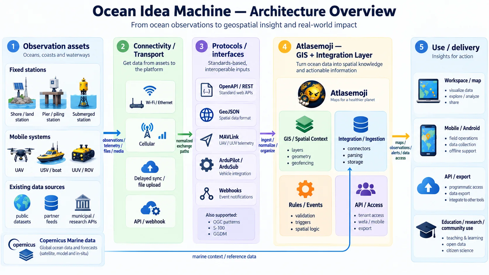
Start with an observation asset: a human, camera, sensor, phone, vehicle, API, or existing dataset. Keep that asset separate from how it connects. Identify connectivity, protocol/interface, and data representation. Normalize only what the project needs while preserving source identity, observation time, units, provenance, and vertical reference. AtlasEvo can provide the spatial project context: datasets, layers, stations, observations, geometry, rules, and outputs. Copernicus Marine or other external data enters as additional context/source layers, not as the final product of the workflow.
Work through an example
A shoreline temperature observation can come from a manual reading, fixed station, or vehicle. Each path can create a comparable observation if it preserves the same core questions. A Copernicus layer can then help learners compare their local observation with broader ocean conditions.
Observation asset
  ↓
Connectivity
  ↓
Protocol / interface
  ↓
Observation + provenance
  ↓
Spatial project context
  + external context layers
  ↓
Compare / map / rule / API / export / collaborate
Practice
- 1Choose one observation asset and trace it through connectivity, interface/protocol, data representation, observation mapping, spatial context, and use.
- 2Use the architecture image to label which parts are source, transport, platform context, and output.
- 3Identify one second source that could be compared without pretending both sources were measured the same way.
Try it
Follow data through a workflow
Select each stage. The goal is to keep the source, connection, protocol, data, spatial context, rule, and use understandable instead of collapsing everything into one box.
The real-world fact, device, file, application, person, or system that starts the workflow. If it is an observation, preserve where, when, what, source, value, units, and provenance.
What to watch for
Do not make specialized hardware a requirement for participation. Do not collapse vehicle control into the GIS/integration layer. Do not treat external context data as though Atlasemoji created it.
Where this takes you
Use the project to combine lessons on stations, observations, vertical space, GeoJSON, APIs, MAVLink, S-100 concepts, provenance, GIS layers, rules, and exports into one understandable system.