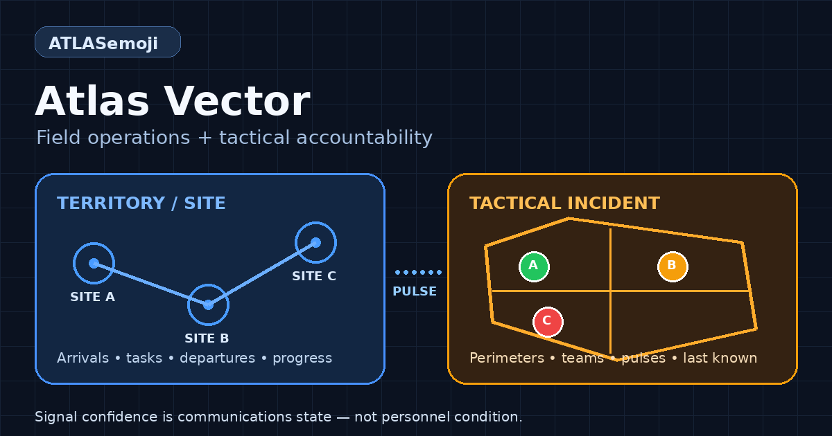
Atlas Vector

Dual-mode geospatial field operations and tactical accountability for recurring industrial work and rapidly formed incident teams.

Atlas Vector field operations and tactical accountability

Where this fits

Atlas Vector gives managers, dispatchers, incident commanders, contractors, and responders one shared operating picture without reducing accountability to a passive dot on a map. It connects assignments, sites, incident boundaries, teams, tasks, evidence, communications, battery state, and the age of the last reported location.

Territory / Site mode supports recurring industrial work such as well pads, substations, utilities, facilities, stores, yards, and service territories. Tactical Incident mode supports temporary perimeters, quadrants, strike teams, mutual-aid onboarding, emergency exceptions, and search-and-rescue operations.

The system is intentionally honest about uncertainty. Green, amber, red, and gray describe communications confidence. A stale or lost link keeps the last-known coordinate, time, heading, accuracy, and battery context visible, but does not claim that a person is missing or safe.

Good fit for

  • Distributed industrial field teams
  • Utility inspection and restoration crews
  • Corporate quick-response teams
  • ICS strike teams and mutual aid
  • Search and rescue accountability
  • Hazmat, fire, and emergency operations
Technical drill-down

Move from business context into implementation guidance

Atlas Vector combines mobile telemetry, geofence evaluation, adaptive pulse policy, incident and territory manifests, teams, tasks, evidence, offline queues, and honest signal-confidence state. The field guide explains operational limits and safety terminology while the workspace demonstrates both operating modes.

Field and safety manual
Works with

Related Atlasemoji solution areas

More solutions

Atlas DataSynch

Map-aware operating hub for locations, partner data, Xref, telemetry, inventory, exceptions, and normalized workflow records.

Locate

Map warehouses, yards, racks, bays, and levels; find items and assets; and share precise operational waypoints using high-resolution spatial indexing.

Geofencing

Build location-aware programs that connect operational places, people, vehicles, shipments, assets, and business rules to entry, exit, dwell, and downstream actions.

CRM

Connect accounts, contacts, partners, campaigns, field coverage, support activity, and customer sites to operational context.

Inventory & Items

Track products, parts, consignment stock, truck inventory, store inventory, and high-value items by location or movement.

Handheld Scanner

Use Android/mobile scanning for pick-pack, scan-n-pack, proof capture, proximity checks, and field-event workflows.

Xref / Partner Mapping

Convert partner, customer, ERP, EDI, spreadsheet, or app-specific codes into usable internal values.

Atlas Intercept

Route alerts, webhooks, exceptions, and downstream actions when operational events need a response.

API & Integration Hub

RESTful access for GCP, webhooks, EDI, EDIFACT, cXML, spreadsheets, apps, and partner workflows.

EDI, EDIFACT & cXML

Learn, build, connect, test, break, diagnose, replay, and continuously regression-test EDI, EDIFACT, cXML, and API-based B2B integrations.

Travel & Routing

Build route visuals for field movement, customer visits, trips, vessels, aircraft, and operational planning.

Learning & Help

Quick starts, field guides, help files, API explainers, and implementation notes for business and technical users.

Keep exploring

Related docs and main pages

Move from this solution page into documentation, examples, the workbench, or another Atlasemoji solution area.